
Google Maps Is Borrowing Another Page from Apple’s Atlas

Toggle Dark Mode
The debate between Apple Maps and Google Maps for the best smartphone navigation app has raged on for years. The number of variables involved in building a perfect database of mapping and routing data means there’s unlikely to ever be a clear winner, as the best choice so often depends on where you live.
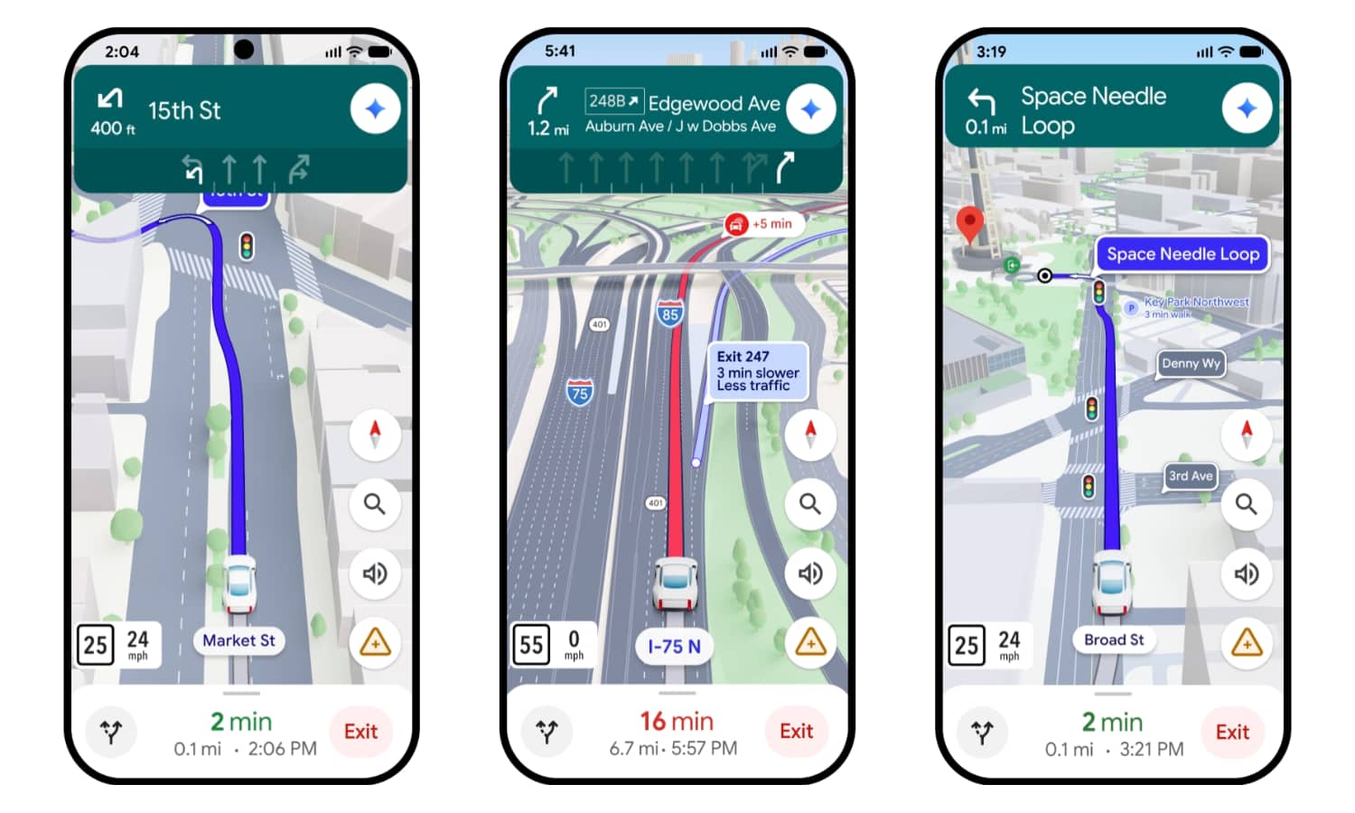
Still, Apple Maps has one benefit that’s hard to deny: it’s gorgeous. Thanks to detailed city experienceswith rich 3D landmarks and enhanced maps for CarPlay, there’s no denying that Apple Maps is far more pleasant to look at compared to Google’s rather utilitarian interface.

That could soon change, though, as Google has finally announced plans to catch up in the aesthetic department through Immersive Navigation. Calling it the “biggest transformation of the navigation experience in over a decade,” the new mode promises a vivid new 3D view with buildings, overpasses, and terrain that will look extremely familiar to anyone who’s been navigating with Apple Maps for the past few years.
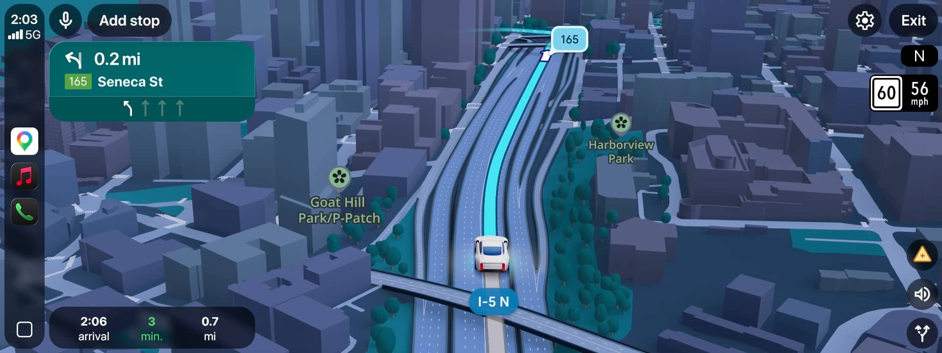
We’re giving the driving experience in Maps its biggest update in over a decade with Immersive Navigation – a complete transformation of the navigation experience, with redesigned visuals and more intuitive guidance. This update helps you stay focused and informed on the road, with fresh, real-world information and natural directions that prepare you for the drive ahead.
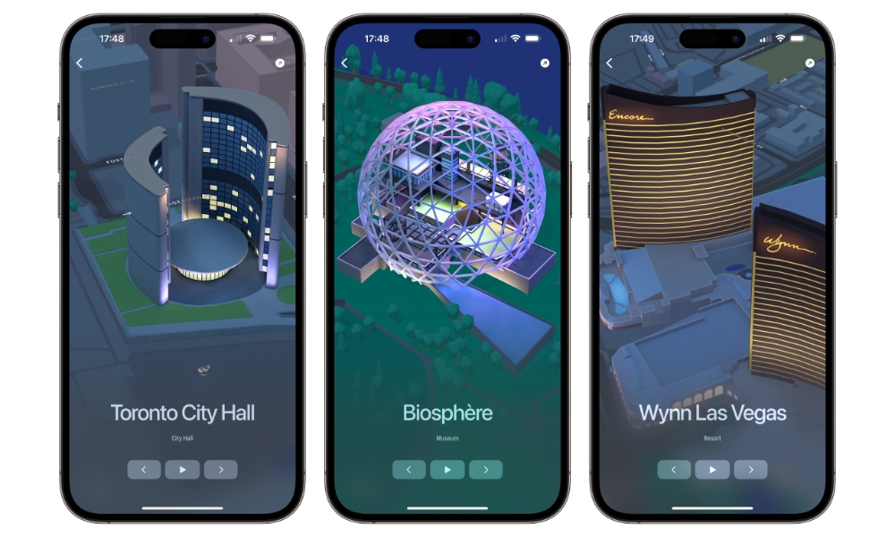
Apple began offering detailed driving and city maps in 2021 with the release of iOS 15, although they didn’t expand to the CarPlay Dashboard until iOS 15.2 came along a few weeks later. The richer maps were initially available in only four cities — London, Los Angeles, New York, and the San Francisco Bay Area — but rapidly expanded, adding San Diego, Washington, D.C., and Philadelphia by the end of 2021, and then into Toronto, Montreal, and Vancouver in the spring of 2022. As of today, it’s expanded to 35 cities, from Amsterdam to Sydney and beyond.
Google is coming late to the party, and it shouldn’t come as a surprise that we can expect Immersive Navigation to roll out slowly before it reaches far and wide. The company hasn’t said which cities are included, but for now it’s only rolling out “across the U.S.,” and “availability will expand over the coming months to eligible iOS and Android devices, CarPlay, Android Auto and cars with Google built-in.”
Immersive Navigation feels a bit like a sequel to the Immersive View the company announced four years ago, promising to render entire cities in exquisite detail using 3D mapping and machine learning, effectively providing its own response to Apple’s Look Around, which was itself an improvement on the classic Street View of Google Maps. In addition to offering an improved street-level view, Immersive View even promised to let folks look inside popular venues like restaurants. As with other similar features in both Apple and Google Maps, Immersive View took a couple of years before it was available beyond the handful of cities where it first launched. It’s a safe bet that Immersive Navigation will follow a similar path.
Navigation Also Gets Smarter
In addition to the eye candy of Immersive Navigation, Google is also bringing Gemini into the mix to provide a more intelligent spatial understanding of your navigation routes, providing a more accurate view of landmarks, medians, lanes, crosswalks, traffic lights, and more.
Google’s machine learning models will also help analyze traffic updates to help you better understand the tradeoffs between alternate routes, like a longer trip with less traffic, a faster one that might involve tolls, or route disruptions like road construction and crashes reported by other drivers. Smart zooms and transparent buildings will also help visualize turns well ahead of time, and Gemini will power a more natural voice guidance. That’s something else that Apple already brought in Apple Maps in iOS 17 — arguably one of the few areas where Siri has actually gotten something right.
Gemini is also bringing a new “Ask Maps” feature to Google Maps, which the company describes as “a new conversational experience that answers complex, real-world questions a map could never answer before” by tapping into Google’s massive database of over 300 million locations and review data from over 500 million contributors. Users can tap a button and get Gemini to answer questions like “My phone is dying — where can I charge it without having to wait in a long line for coffee?” or “Is there a public tennis court with lights on that I can play at tonight?”
Responses will also be personalized based on previous searches and saved locations in Maps, so Gemini will already know what types of restaurants you’re likely to prefer, for example. Google says that Ask Maps “starts rolling out now in the U.S. and India on Android and iOS, with desktop coming soon.”