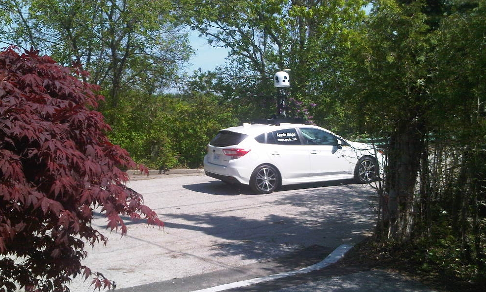
More Apple Maps Cars Spotted Rolling Across Canada
 Credit: Andreas Bach
Toggle Dark Mode
Apple Maps has far too often found itself the butt of jokes about its weaknesses compared to the arguably more popular Google Maps, and while its reputation isn’t entirely undeserved — it definitely started at a disadvantage — Apple has already made some remarkable strides in catching up to its rival when it comes to its mapping data, and it continues to put no small amount of effort into ensuring that iPhone users can rely on Apple Maps.
Earlier this week, we saw another example of just how far Apple is willing to go to improve Apple Maps — over 4,000 miles in fact, according to a rare public announcement that the company made about its mapping data collection plans this week.
Beginning in May, Apple Maps will be driving across Canada throughout the summer. We’ll be capturing road details, signage and landmarks — all to make the most accurate and useful Maps experience possible. The information collected will be worked on by our teams in Cupertino, California. We plan to publish this data in a future product update.
Apple Press Release
Apple published an announcement in newspapers across Canada, advising the public that they can expect to see a fleet of its clearly marked mapping cars rolling around their neighbourhoods over the course of the summer, and in fact we’ve been receiving numerous reports of sightings already, such as the photo shown of a small white four-door hatchback roaming the residential cul-de-sacs of East York in Toronto. What’s particularly notable is that Apple’s cars aren’t just covering major thoroughfares — this particular car was spotted at the end of a small dead-end residential street, suggesting that Apple is determined to be extremely thorough.
A camera array mounted on top of the car is clearly collecting visual data in multiple directions, although it’s unclear whether Apple is just using this for internal review for capturing things like addresses and street signs or whether it’s part of a larger plan to roll out a rival to Google’s Street View feature.
Apple has published a detailed list of the specific towns and cities that Apple’s mapping cars are expected to be driving through, from May to November, across all ten provinces. It seems that the territories of Yukon, Nunavut, and the Northwest Territories are being left out of the fun; although these are pretty sparsely populated areas, it would still be nice to see Apple at least cover the handful of larger towns and cities in the area, since Google actually has successfully done this, even offering Street View footage.
In the press release, Apple also of course confirms that it will also take every precaution to respect user privacy, working with local regulators to ensure that all of the relevant privacy laws are followed, which will likely require redacting any information that could be deemed personally identifiable.
Last year, Apple announced a massive overhaul of Apple Maps, stating that it would be rebuilding the service using its own first-party data, rather than relying on other providers like TomTom as it had done in the past. The move is said to have been several years in the making, suggesting that Apple ultimately intended to go with its own data from very early on, but was forced to rely on third parties to get its mapping solution out in time.
It’s also long been speculated that the mapping data that Apple collects could also be used to bolster its self-driving car project, although whether that data will be directly used in training autonomous driving systems is less clear. There’s no doubt, however, that an accurate and robust mapping system is going to be integral to the launch of Apple’s own car, since the company almost certainly won’t want customers even wanting to install Google Maps in an Apple Car, so it’s easy to see why the company is redoubling is efforts to improve its reputation when it comes to mapping technology and accuracy.


