
Apple Maps Adds Transit Features in Select New Cities
Toggle Dark Mode
Introduced in 2012 as a replacement to the previously enamored Google maps client for iOS devices, Apple Maps has come quite a ways since its initial debut to mixed fanfare from customers, tech journalists and experts, alike. Now boasting many of the same features as its predecessor, Apple Maps has become a widely popular and viable solution for your mapping and location-based service needs on iOS hardware, Macs, and even on the Apple Watch.

With last month’s release of iOS 9, a slew of new features have made their way the platform, as well, thus enhancing the former iterations of Apple’s homegrown mapping solution.
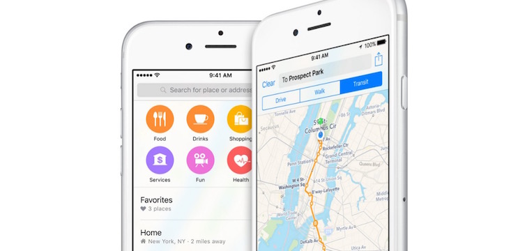
Principally among them is the new transit directions functionality, which gives users a comprehensive breakdown of routes, departure times, and other relevant data. This function works for bus, train, ferry, subway, and other forms of mass transit schedules and locations within the confines of select cities around the globe.
Apple has also pledged to continuously add cities to its list over time, however, as it stands, Apple transit directions are available in the following markets: Baltimore, MD; Berlin, Germany; Chicago, IL; China; London, England; Mexico City, Mexico; New York City, NY; Philadelphia, PA; San Francisco, CA; Toronto, Canada; and Washington, D.C.
In an effort to deliver on its promises, Apple on Monday added the transit direction information in two additional markets to the list on its website — Boston, MA, and Sydney, Australia.
The transit feature in Apple Maps also gives users a top-down view of underground subway and train stations, which is a unique new feature for Cupertino’s mapping service. With the inclusion of this new feature, commuters can now more efficiently plan their routes without getting lost somewhere along their journey. In addition, the transit data is customized for each location, meaning, essentially, that road signs appear in the app just as they would in real life.
Apple’s transit direction feature is brought to you in part through various technologies obtained through recent acquisitions, such as those of HopStop and Embark. These web-based services are powered by any of several data sources available within their respective locations.
Maps over the years
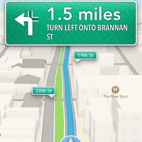
Since its bittersweet debut alongside the release of iOS 6.0 in 2012, Apple maps has seen quite an improvement; in some instances, growing to be even more efficient, user friendly, and feature rich than its competitors. Apple improved the maps experience dramatically with subsequent releases of iOS 7, 8, and the most recent iOS 9, which means the program now includes features such as turn-by-turn, voice assisted navigation, 3D ‘City Tours’ and Flyover in select markets.
So, you haven’t taken a look at the revamped Apple maps application lately, give it a shot — there’s always room to grow and places to go!