
New Apple Maps Update Makes Public Transit Easy

Toggle Dark Mode
Public transit users have been begging Apple to include buses, trains, and subway systems into their Apple Maps software, and it seems that Apple has taken note. During the Worldwide Developers Conference this morning, Apple announced a huge update to Apple Maps in iOS 9. Several new features were added to the update, including the re-introduction of mass-transit directions and navigation.

Apple Maps was first released in iOS 6, when tension between Apple and Google led Apple to stray from Google Maps. Apple Maps was plagued by bugs and navigational errors early on, but has since grown more efficient and accurate – and thus more popular. However, one feature has been notably absent for several years now – transit directions. Now users who commute using buses, trains, subways, and ferries can receive step-by-step, multimodal, directions to get from their origin to their destination.
Apple’s Craig Federighi introduced the update on stage at the WWDC this morning. Federighi noted that Apple has worked feverishly to “get things right” with the app – the Transit feature will even help you find the nearest entrance to for your train or subway stop, helping users save time and catch the right train at the right time.
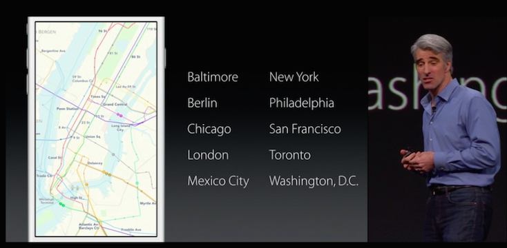
Transit directions will be available in select cities at launch. Users in San Francisco, Baltimore, New York, Philadelphia, Washington DC, and a select few others will be able to take advantage of the new feature when iOS 9 becomes available. Abroad, users in London, Toronto, Berlin, and several cities in China will receive the Transit directions as well. The inclusion of Transit directions should increase the popularity of the Maps app among Apple users in large metropolitan areas. Already the most popular mapping app on iOS devices, this new feature may turn the remaining Google Maps-standouts into Apple Maps users.